Friday, December 23, 2011

Mount Washington Winter Hike

On Dec 22 Sam and I celebrated the new winter by driving up to New Hampshire. We slept in the back of the truck with the alarm set for "in a little bit". Things were dry and cold when we went to sleep and when the alarm went off things were still cold but there was also 3 inches of fresh snow everywhere. Eventually we got everything packed up and started wandering around in the dark looking for the trail. We started up around 6:45 or so just as it was starting to get a little bit almost barely light. The trail was wide and pretty obvious despite the fresh snow. Unfortunately under the snow was a mix of gravel, rocks, and ice. We both slipped and fell over or at least to a knee or hand a few times. There were 2 groups ahead of us and we followed them on what we thought was the turn off to Lion Head trail - it actually wasn't and eventually we noticed this and backtracked a bit and took another trail that rejoined the Tuckerman Ravine trail. From there we found the correct trail and started up.

Sam where we first started to get some visibility
Soon things started getting steeper and we put on crampons. Between my heavy leather boots, steel crampons, and heavy gaiters my feet felt very heavy - but they stuck on the ice. As we got higher up the trail the snow eased up and we began to get a little visibility. We were both pretty hot at this point but didn't want to actually take off any more layers. Near the top of the Lion Head trail we even saw a little bit of sun. Then we came over a point and the wind picked up. This helped clear parts of the trail but drifted other parts. Where the trail passed through the Krumholtz it was a little more sheltered again but beyond that was pretty windy again. It was nice to have a balaclava and ski goggles. The cairns - rock piles to mark the trail - up here were very big and close together so that they could be followed even in a whitout. We could usually see at least 6 at any one time. There were little rime ice fingers growing all over towards the direction the wind comes from. I didn't see many bigger than a few inches, but they were impressive in their number.
We barely saw the sun for a little bit


rime ice formations


When we turned N towards the summit the visibility was going down and the wind was coming up. Also the footing was harder because it was larger rocks underfoot but many of the gaps between them were filled with drifts of snow. It made for some slow plodding progress but by 11:30 or so we made it to the parking lot. From there we went up to the buildings and found the summit sign. I thought the visibility was completely going but it was only ice covering my goggles (and just about any other surface). It was forming amazingly fast - you could see it cover the camera lens among other things. (we took Sam's camera up because mine probably wouldn't have handled the conditions well). (most of the photos here are ones Sam took, although you will have to wait for my trip report to see his "arty" shots.

Tom hiking up past more rime ice and rocks
At the top the wind was windy (40 to 50 according to the summit weather station we were told) but we measured only 25 on Sam's wind meter as well as a bit under 20 degrees F with a windchill in the negative numbers. It was cold, especially as ice was forming on just about everything. We had more warm clothes but rather than stick around and get everything ice covered putting it on we just headed down. We made much better time heading down at first, especially as there was a bit more snow and the wind was from behind. We passed 4 groups that were still coming up (including one group ahead of us that also took the wrong turn but continued on up Huntingdon Ravine). The final part of the trail seemed to take forever, but we got back to the parking lot by 3 or so. As far as elevation goes it was a little lower than going from Phoenix to Flagstaff and back, but the weather was a lot more severe. It was enough to give us a good taste of winter and not have it be totally casual but the unpleasantness didn't actually last very long. I would have liked to have a few expansive views and some wind and snow free times to swap out lenses though. Still, I have to rate it a highly successful trip.
Sam and Tom icing up on the summit of Mount Washington


here is a link to the spot track - unfortunately it didn't start registering until we were a good ways into the trip and it didn't get us on top. - zoom in to the satellite view to see some of the buildings up top.

http://www.spotadventures.com/trip/view/?trip_id=288840

Thursday, November 3, 2011

October at the Red River Gorge

I finally made it down to the Red River Gorge at the end of October. Boy am I out of shape for the endurance steep climbing here. Still, it is fun. There were a few cold and wet days with even a bit of snow, but mostly the weather has been nice.
Derek climbs up a map of Africa at Muir Valley

For a Halloween party I dressed up as a carrot, unfortunately I neglected to get a pic of myself in costume. Maybe I can get one from someone else.


Halloween party at Miguel's


Meanwhile I am working on getting my strength and endurance and skin up to where they need to be so I can climb some new climbs.  As usual there are lots of people here I know, so that is fun.
Looking up in the deciduous forest - most of the leaves are gone

Natural Bridge arch - a rest day walk

The last few days the weather has been absolutely gorgeous, unfortunately my back has decided to hurt, I can still climb, but getting my feet to the holds isn't always easy. The crux is getting my shoes on though.


I last saw Kim at the Owen's River Gorge

Here she grabs "India" on Tissue Tiger

A beautiful day at Eastern Sky Bridge

Derek at Fantasia
Zac at Driveby

Monday, September 5, 2011

Kids in the woods - not a sufferfest

My sister's twins wanted to go camping, so what better time than when "mad uncle Tom" is visiting - someone who actually enjoys camping. So we did some research, looked at the weather, changed our plans, looked at the weather again and again (over a few days) , and changed our plans again. Then we hastily packed up the car and off we went to Wompatuck State Park.


First we set up the tents and then went on a deathmarch (to hear some of the kids complaining you would think that was the case, but it was probably under 2 miles - it definitely wouldn't have made it into the Sierra Challenge). We summited Prospect Hill (I think, it was a little hard to tell where the summit was in the woods - it looked a lot more impressive on the map 'til I realized it was a 10 ft contour interval). There were lots of old stone walls heading through the woods and various dirt paths, old roads, and paved paths. Also there were what looked like drumlins, except sometimes they had vents on top or doors on one end - they were old bunkers from when this was an ammunition facility. When we got to Holly Pond it was a lot brighter. Unfortunately the rocks covered in turtles were pretty far out. Then on back to camp.

trail at Wompatuck State Park

On the shores of Holly Pond

Bunker in the woods

Back in camp we started a fire. First I wasted a lot of time trying to light it with the flint and steel. I got some flames a few times, but everything was pretty damp, so I didn't actually get the fire going. We resorted to a lighter, and that didn't work 'til I shaved a stick down to shavings and used them to get things going. I have spent numerous hours of my life messing with campfires, so I have forgotten how much fun it can be. The twins enjoyed it immensely. For dinner we roasted sausage on sticks, and pepper, and biscuits on the grill. mmmm. Later we had hot chocolate. The fire got more attention before it was time for bed. It was pleasantly cool but not cold at all and the mosquitoes weren't noticeable. This was camping lite.

playing with fire - Wompy the fire demon


Unfortunately some nearby campers had a propane lamp that lit up one side of the tent and my sister had forgotten her pillow, but otherwise sleeping wasn't bad.

The next morning we played with the fire more, cooked eggs, did a little bit of slacklining, and whittled sticks (including a totem for Wompy - the fire demon we had been keeping in the fire pit) before packing up and driving home. A good time was had by all and we cut down on nature deficit disorder in the next generation.

Tuesday, August 30, 2011

End of the Challenge and a long drive

I finished up the Sierra Challenge with an 18 hour push from Whitney Portal. It was a long day but I did manage to squeek out a victory in the race for the polka dot jersey. Then I crashed in the back of the truck.


It is a long long way across this country

My next mission was to drive across the country for my cousin's wedding. I stopped off in Manzanar to take a few pics and my truck wouldn't start- the key would only turn a bit in the lock. After much messing and wiggling and so on I gave up and got it towed to Lone Pine to get the lock replaced. Unfortunately they had a bit of a search for a replacement. but eventually it was replaced and I could be on my way. By 7 pm I was heading north out of Bishop. I got well into Nevada before I needed to stop for some sleep. The next day I had a blowout on highway 6. It took about an hour to get out the jack and put on the spare and during that time about 5 people passed me. Between changing the tire and then buying a new one that wasted a few more hours. I was able to pick up my backpack which I left in SLC. Thanks Bob. I slept somewhere in the middle of Wyoming that night. The 3rd day was a long one, the rest of Wyoming, all of Nebraska - and it is a lot, and all of Iowa. I didn't get very far into Illinois before I had to sleep though. Then another long day taking me through the rest of Ill, Indiana, Ohio, and much of PA. That allowed me to make it to Boston around noon on Friday. oof.

The wedding was nice even if we were starting to get the front of Hurricane Irene. The next day we elected to stay home and not drive. The storm brought a lot of rain and wind and a few downed branches with about 2 hours with no electricity. It seemed to mostly hit to the west of us. My brother however had to be back for work on Monday and as a consequence had to rent a car and drive all the way to Rochester to get a flight. oof. He did make it though.

I started on my trip report for the Sierra Challenge here:

http://www.electricant.net/grundyman/schallenge2011.html

I hope to continue improving it though.


Monday, August 15, 2011

2011 Sierra Challenge Day 4

2011 Sierra Challenge Day 4 - lots and lots of sierra day hiking and peak bagging, that is for sure.

4 days, 9 peaks, lots of miles (80 or more?) and lots and lots of vertical. I am tired.

I made spot tracker pages for each day... (1 - 4 in order)

 http://www.spotadventures.com/trip/view?trip_id=272783

 http://www.spotadventures.com/trip/view?trip_id=272784

 http://www.spotadventures.com/trip/view?trip_id=272785

http://www.spotadventures.com/trip/view/?trip_id=272786

I think I have the virtual polka dot jersey for "king of the mountain" - most peaks. I am nowhere near the yellow leader jersey for the fastest times though (doing bonus peaks hurts that, so does being slow and taking photos).

so far so good, although I am tired.


Wednesday, August 10, 2011

upcoming suffering - the 2011 Sierra Challenge.

This year I plan to participate in the 2011 Sierra Challenge. Basically 10 days of long day hikes to mostly obscure peaks with between 15 and 25 miles of hiking and 4,000 to 6,000+ feet of elevation gain. Sounds great eh? Unfortunately about 2/3 of the way through a hike up to the top of Wheeler Peak on Tuesday I started feeling lousy. By that evening I was pretty miserable with a general weak feeling and everything from the neck up being very unhappy. I went to bed by 8 and didn't get up until 7:30 the next morning except to drink water and go to the bathroom (breathing through my mouth made me very dehydrated). I feel better today, but this isn't how I would like to feel a few days before 10 grueling days are about to start.


Some more info on the Sierra Challenge can be found here:

http://www.snwburd.com/bob/challenge/2011/

with a summitpost page here that might have updates once things start.

http://www.summitpost.org/phpBB3/2011-sierra-challenge-aug-12-21-t58180.html

I will take my spot tracker with me, so you might be able to track my daily progress here:


http://share.findmespot.com/shared/faces/viewspots.jsp?glId=0Dc9Uh3Nfi5gSoXCZcVqStstGq6beNZ8X

I'll try to update things from time to time, but I might just curl up and go to sleep after every day rather than get online and update things.


here is my spot track page for Wheeler Peak

http://www.spotadventures.com/trip/view/?trip_id=271694

Monday, August 8, 2011

short update from Wanderlust and the OR show

Once again life has been hectic, which is nice, but hectic.


Sam walks a water line at Lake Tahoe


Wanderlust was fun, as you might expect. How can you go wrong with a yoga - music festival with a heap of Yogaslackers? Among other things we did a human anchored line over the high camp pool. Here is a link to a pic someone else took of it.

http://unofficialnetworks.com/line-week-day-pool-34423/

After Wanderlust it was off to SLC for the Outdoor Retailer show where I helped set up the Prana booth and the Rejuvenation room, wandered the exhibit halls looking at all the shiny new things, hung out with fellow Yogaslackers, and didn't get a lot of sleep.


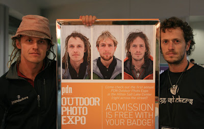
These pictures of Sam, Paul, and Jason were all over the show

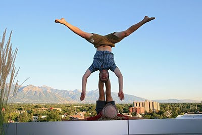
Sam and Dan do some acro on the 5th floor roof of the SLC library


We escaped a well behaved zombie apocalypse in a large SUV

then went on to pioneer the sport of acro yoga pool - here Sam breaks from bird


Next I plan on heading back to the Sierra with a stop in Great Basin Natl. Park to head up Wheeler Peak, and then try my hand (and more importantly feet and legs) at the Sierra Challenge. My prediction - Pain.


Friday, July 22, 2011

Latest doings - big day in the mountains and now Squaw Valley

Well, I haven't reported on my doings for a while. I had a big day in the mountains July 12th. I hiked in from Pine Creek up to the Morgan mine and then along the ridge over a number of peaks such as Broken Finger with a fair bit of scrambling and up to low 5th class climbing and lots of confusing and tortuous route finding. Then over to Morgan Peak and Little Lakes peak and then back to the trail to hike out by moonlight. It ended up being about an 18 hour push and I was quite tired. Someday I'll make a trip report for it. The spot track is here:

spot track for big day in the Sierras

I also did some mountain biking and scouting of Bishop Creek for packrafting - too much brush though.

Now I am up at Squaw Valley to set up for Wanderlust. Lake Tahoe was very blue, but the traffic was grim. I was getting passed by bicycles.

Lake Tahoe - very blue. I think I had the polarizer on for this pic

Monday, July 11, 2011

short Owens River Packraft (7/10/11)

I got a pretty late (Yogaslacker) start on a packraft trip on the Owens River. I parked my truck at the Five Bridges bridge over the Owens, then I biked up to the Pleasant Valley Campground with my raft. This was into a headwind and took about an hour. Then I switched to raft mode (20 minutes) and cast off downstream at 5:17 pm. The water might have been a little higher than last time, but not by much. I didn't stop at all and made it down to the bridge in about 2.5 hours. I surprised a number of great blue herons and a hawk when I came around corners, but there were less little flitty birds than the first trip. The new packraft handles well without a bicycle on the front. It is definitely narrower than my old raft was.

I also got my spot tracker back (Thanks Frank), so here is a link to the spot track from this trip. You can see how squiggly the Owens is for some of this stretch.

Link to Tom's spot track of this short Owens River packraft trip

Sunday, July 3, 2011

back into the mountains - June 28 to July 2

This will be quite brief, but I hope to update it in a few days when I get more easy internet time.

I got another call and headed into the mountains. This time I headed in from N Lake up over Piute Pass. The first night it snowed a few inches and it blew a lot. In the morning it was still blowing around but I decided to get up and out anyway. I ticked off a number of smaller peaks in the 4 Gables area including what is apparently officially the 4 Gables peak as well as the more impressive peaks to the N and S. Then I moved camp closer to the next days objective - slow and frustrating with the soft afternoon snow - it is at least twice as fast with half the effort to walk on top of the snow in the morning.

The 3rd days objective was Mt Merriam (13,077'), Royce (13,280 ft), and possibly Feather Peak (>13,240 '). I managed all 3 and found a nice couloir for the descent from Feather that saved me a lot of tedious downclimbing. Once again the afternoon snow was a chore to pass. I think this was my longest day with over 4600' of vertical. Once again it snowed (and blew around) in the evening - just enough to make me pack up and hide in the bivy tent instead of drying stuff out.

For the 4th day I hiked back and climbed up Mt Humphreys (13, 986 ft) via the NW side - this had some exciting climbing - something about 4th classing past rappel anchors makes one feel both superior and nervous. From there I headed south towards the final objective.


my shadow as I hike back towards Humphreys


The 5th and last day I climbed Mt Emerson from the SW. There was some scrambling to start and a lot of talus up to the lower W summit, then I traversed and scrambled around a lot of ridge to the actual E summit (13,204 ft). This day was a lot warmer with almost no wind. I took the gully SE from the summit, I think this was a big mistake as it had a lot of loose scree and rock, and then pinched down and had some waterfalls and sketchy old snow. I was glad to have my crampons although I wasn't glad to be putting them on on a little ledge. I also had my full backpack with all my stuff. Finally I made it down to the main Piute Pass trail and back to the truck. Down at the trailhead there were a lot of mosquitoes.


I look out over Piute Pass from the SE shoulder of Mt Emerson


It was fun to recognize so many names in the summit registers. Some peaks are a lot more popular than others, with only a few ascents a year, others see many ascents each year.


Another dip in McGee Creek refreshed me, but I had to scrub and scrape the paste of dead skin and sunscreen off of my cheeks.


here is a link to a slightly more complete trip report of the Mount Humphreys Basin trip

Monday, June 27, 2011

The mountains called again - Agassiz, Isosceles, Columbine, and Goode


The mountains called again, I think they have me on speed-dial. So I went. This time I hiked in from South Lake - looking pretty empty for some dam work. It wasn't long before I was on snow and I was skinning to go up Bishop Pass. From there I dropped the pack and skis and went up Mt Agassiz - this is the 3rd Mt Agassiz I know I have climbed. I presume they are named for Louis Agassiz - a geologist among other things who proposed that the earth had an ice age. This peak is 13,891 and overlooks the North Palisades. My first experience with these was the Thunderbolt to Sill traverse I did w/ Kim a few years ago - a most excellent adventure.

By the time I got back down to the gear it was getting late. I traversed and skied down a bit into the Dusy Basin and found a nice dry mostly flat spot with a wind break to set up camp.

The next day I headed up on the most excellent styrofoam snow to the Thunderbolt col into the Palisade basin. There I realized my mistake as the ridge west from there was very ridgey instead of easy walking on the south side that I expected. I scrambled and traversed along this ridge for the rest of the morning. Then I climbed up to the summit of Isosceles Peak. It had a rather exciting and technical bit to get up to the 12321 ft diving board summit. I celebrated with some grease sticks (cheese and pseudo meat).

grease stick celebration on the summit of Isosceles
Columbine Peak from Isosceles
Then back down to the south and up the N ridge of Columbine Peak. This was more of a pain than I expected because by now the snow was getting soft and treacherous (as far as post-holing was concerned). The 12652 ft summit of columbine peak was a spike of rock jutting up at an angle - something you would expect from a movie, not reality. I set up the camera with the remote control but it was too far away to trigger from the summit, so I set the timer and ran. The first time I didn't get there, but the second time I made it up. I took a slightly better descent route back to the pack and water.
running for the summit of Columbine

this time I made it (and managed to stop in time too)


panorama of the Palisade Basin from Columbine


There I switched into ski gear and dropped into Dusy Basin. It was pretty soft and forgiving. From the lake I was able to boot it back up to my camp. I saw 4 people,  mostly on snowshoes heading over the Thunderbolt Col I had gone to that morning - these were the only people I saw on this trip except within 4 or so  miles of the trailhead.
super blue melting lake edge in Dusy Basin

That night it wasn't very windy and I had to actually remove layers to keep from sweating. Amazing. The stars were also very nice. I took some pics.

Sagittarius, Scorpio, and the Milky Way over Isosceles and Columbine peaks

For my last day I headed north up over some peak (12,916 ') and along the ridge (with treacherous snow that tweaked my knee when I post-holed) to the 13085 ft summit. I was able to ski from almost the summit with the usual scary steep start (although it was pretty soft at this hour). I had to walk one little bit where the snow was all melted out and then was able to ski the rest of the way down to Saddlerock Lake. I did have one exciting wipe-out when something grabbed the back of one ski, turned me around and ripped the ski off. Luckily it was relatively low angle here, so I mostly just went down.


Long Lake with Mt Goode behind it (I went down the side behind to the left)


For a while after the lake I was able to combine walking and skiing, but by Long Lake I gave up and switched back into the comfy boots and footed it the rest of the way back to the truck. I spent a little time walking around on the bottom of S Lake (lots of fishing trash). Then back towards town to camp by McGee Creek which afforded me a cold but refreshing and cleansing wallow.

I just want to add that I am completely annoyed with how blogger deals w/ pics, especially moving them around, or not as the case may be. Who designed this mess? I had to go into the HTML and tell it what was up.

Here is a link to a slightly more complete Dusy Basin area trip report

Tuesday, June 21, 2011

The Mountains were calling, so I went (University Pk, Mt Rixford, and Mt Gould)

I had a nice little break going to a wedding in San Diego, hanging out with friends, mountain biking, a bit of boogie boarding... It was nice. Then on up to LA for more mtn biking and some kayak surfing. Actually I was on a wave ski. It was fun although a bit crowded at San Onofre with heaps of stand up paddle boarders. The waves got better as time went on and I had some pretty good (for me) runs. I also got flipped and swirled in the waves a few times. I did manage a few rolls too, which is always satisfying. With the waveski it wasn't too bad to get flipped and swim though except the one time I tried to roll too many times and got hit by another wave just as I was unhitching the seatbelt. I got a lot of the pacific in my sinuses and it continued to trickle out over the next few days. ugh.

Then I stuck around for another day on the computer and to eat ice cream before heading back to the mountains. I got a permit in Lone Pine and then camped out in the Alabama Hills.

Alabama Hills panorama including Mt Whitney
I headed up to the Onion Valley trailhead and started in towards Kearsarge pass. At the 3rd lake in I cut left and up towards University Peak (13,589 ft) or maybe 13,468 feet or even 13632 ft. Eventually I got sick of carrying my pack and I dumped it and the skis and headed on without the load. I wasn't entirely sure that I'd manage to get up the way I was going, but with a little scrambling and some snow I did manage to summit. At this point it was getting late and cold. I decided to descend another way to avoid downclimbing one dicey move, but this dropped me off at a steep snow field. Someone else had skied right down it most impressively, but I carefully kicked steps down. I think I'd have been a little more aggressive if I had an ice axe, but I didn't, so I went down carefully. There was also some annoying post holing and loose scree and talus, but I did finally get back to my pack around 7:30 pm. I found a small flat spot and made it big enough to lie down on and cooked dinner. It was pretty cold and windy, but I had 2 sleeping pads (I thought I might sleep on snow) and my warm down bag so once I got inside I was warm. It would have been nice to have a lighter pack, but since I didn't have any other Yogaslackers with me for insulation I had to carry it myself. It was windy all night, but the sunset was spectacular and as I said once I was bundled up I wasn't cold.


Sunset from my bivy ledge
The next morning I was treated to a beautiful light show as the alpenglow lit up the cliffs and snow plus a nearly full moon. I packed up and traversed a bit (I had to put on the crampons to cross a short steep hard snowfield) until I got to a spot where I wanted to start skiing. The snow was still hard so I took a break and cooked up breakfast (there was better wind shelter here too). Then the snow was a bit softer (maybe) so  I skied down to below a pass and kicked my way up and over to Kings Canyon National Park.

Morning view from my bivy ledge - Mt Gould is on rt, Mt Rixford the snowy peak b/n the 2 rocky closer peaks, I crossed the snowy pass on the left
There I skied down to Kearsarge Lake where I put the skins on the skis and traversed around, over a ridge, around another mostly frozen lake and to a nice looking flat spot. I took a break here and then left most of my food and sleeping gear and headed up towards an unknown mountain that looked doable (I later found out it was 12,887 ft. Mt Rixford).

Here I am on the icy shore of Kearsarge Lake. University Pk on the left
I skinned up a ways and then stowed the skis and switched boots and slogged up the talus forever. Finally I got to the top of the snowfield I had scoped for skiing. I left the rest of my gear here and hot-footed it up to the summit. It didn't seem that far, but from a distance I could see I went quite a ways w/o my skis. The descent was scary because the slope got much steeper at some point below me so I couldn't see all the way down (also there was a little rocky cliff band I had to thread my way through). But the snow was soft and forgiving and I finally was able to spot a line down the steeper bit. I did unleash some small slush avalanches in the steepest section but I just waited off to the side for them to stop creeping downhill before threading the rocky bits. Unfortunately I wasn't able to drop all the way down to the main valley snowfield where the rest of my stuff was so I had to take the skis off a few times to get there. It was nice to be cooking without a lot of wind and to dry out my sweaty clothes before bed. It was so warm without the wind I didn't even wear all of my clothes that night.


On the Summit of Rixford Pk. University Pk behind me
For my last day I wasn't in that much of a rush, and I ended up talking with a hiker who went by for a while. Then I hiked up to Kearsarge pass (the snow was still hard enough to walk on top). There I talked to some PCT through hikers for a bit and then headed up Mount Gould to the north. For the most part I was just walking up scree and talus although I did follow some steps up a steep snowfield at one point. I was entertained by the "top 100 songs of the 80's" - I'm not sure who decided this list though. I was trying to play name that tune and artist and did fairly well, although less well with the year. Eventually I scrambled to the summit only to see that the next pile of rocks was higher, so I went up that one to the 13,005 foot summit of Mount Gould. Then I continued on across an alpine tundra to a few radio repeaters and a nice view down into the Rae Lakes basin. I tried my cell phone but despite 4 bars it said "emergency calls only".  Then I descended back to Kearsarge Pass where I talked with more PCT through hikers and gave one group the rest of my sunscreen (you would get totally crisped without it between the altitude and the snow and theirs wasn't sweat proof and didn't seem to be working so well). Then the stalling was over and I strapped on the skis and dropped over a steep edge and started traversing along the long diagonal trail down. I managed to get down past the second lake with only a little bit of walking and scrambling. Then I switched back to the comfy Inov-8 boots and hoofed it back to the trailhead. There I cooked up a batch of spaghetti while drying some gear and slowly repacking the truck. I also talked with another group of through hikers that I saw coming out when I was going in. It is definitely the season for them all to be passing through.

It was still pretty warm down in the valley when I finally got there, but I still enjoyed soaking in the hot spring  water once it got dark and cooler.

I put a slightly more complete trip report up here:


University Peak and other Sierra peaks trip report

Friday, June 17, 2011

Random Acts of Acrobatics - Las Vegas Style

Here is a video Ben Fullerton put together of Sam and I playing on the Las Vegas strip one night. If nothing else it amused us. I especially like to reactions and the non-reactions of the people around us.

http://vimeo.com/25238141

Maybe there is an easy way to embed a vimeo link, but I don't see it right now.

Tuesday, June 7, 2011

Bishop Part II

I've managed a few more adventures in Bishop.

Owens River Packraft...

Loaded packraft from the front
I put in at the Pleasant Valley Campground with my loaded packraft - loaded with not enough insulation and my bicycle. The Owens is pretty narrow, but it is also deep and squiggly. Sometimes it seemed like I was paddling down someones intestines. The current was weird too. I am used to rivers where as long as you go where the water goes you are mostly fine. This wasn't the case here, the current would head across the river to the bank and then go underwater. Then it would come up somewhere else and head sideways for a bit before heading down. Add in a lot of willows overhanging the banks and a few strainers (only a few went all the way across the river though) and it was definitely heads up paddling, especially the first day. The bicycle on the front of the boat didn't really help either, but it does open up some interesting trip possibilities and I could have taken out before the aqueduct had I not made it that far.

I paddled downstream for most of 2.5 days. I don't know how many river miles I went but it sure was a lot more than the straight line distance. I only took one longish break when I flipped in a water control structure and one of my dry bags got caught in the hydraulic. It got maytagged for about 15 minutes and finally got flushed perhaps because it got a hole in it. After I fished it out I stopped to dry things out for a while. Generally the days were warm to hot and the nights were cold. Unfortunately my sleeping pad developed some holes so I was without its padding. Combined with the early mornings, mosquitos, and cold nights I didn't sleep very well. Most of the time I was paddling into a strong headwind. Luckily the river wasn't very straight and usually had reeds and trees on the banks so I could usually pick a lee shore. When I was forced to paddle straight into the wind I just dug down and went as fast as I could. This didn't work in the one lake I had to paddle across. This was just painful.

I did see a lot of wildlife though, deer, beaver, some sort of weasel or otter? and lots and lots of birds - maybe 30 or so different kinds. Especially waterfowl and flycatchers and little warblers and lots of raptors.

interesting clouds

cloud detail

I took out at the start of the Los Angeles Aquedect about 10 miles south of Big Pine. Then I assembled the bike and strapped everything on it and headed back. For the first 5 miles on 395 I had a glorious tail wind and cruised along at around 20 mph, then it swung around to around 10 oclock (front left) and my pace went way down. If I believed that God micromanaged things I'd think he hated me, or maybe she is my personal trainer and thought my legs needed a bit of work after sitting for 2.5 days. I stopped off at the Keough hot ditch for a soak on the way back. I think the total biking distance was around 37 miles. The river had to be 2 or 3 times that.
Water intake for the LA Aqueduct

waterfall near where I was camping
I met up with Julie and got to catch up a bit and check out her cool house and garden. Then I did more bouldering at the Buttermilks and a bike - hike - ski - climb ascent of Basin Mountain - via the E couloir. This took longer than I thought it would, but I just checked and it is 13240 ft / 4036 m tall and I was starting around 6,600 ft, so that explains some of it. The weather wasn't very auspicious when I started with low clouds and a bit of snow, but the clouds rose as I did and I even got a fair amount of sun. The fresh snow was nice for skiing.

Basin Mt from a distance. I went up the middle and then up left on the snow and up the left skyline

Here I am on top

ski tracks on the descent - sure beats walking

Saturday, May 28, 2011

Bishop part I, 2011

I headed to Bishop. On the way I stopped near Cadiz to search for trilobites. As my sister says "Everything is better with trilobites". Unfortunately I only found busted pieces of them - mostly head segments - at least that was what I could identify. Still, it was fun poking around amongst the rocks and definitely better than not finding anything. Then I headed on passing through the Alabama Hills for some pics of Mt Whitney etc.

In Bishop I headed up to the Buttermilks to get schooled by the boulders. I am weak and my skin is soft. I am working on it. I think I can safely say that I am projecting some of my old warm ups though... Well, maybe they weren't quite warm ups back when I had some power.

Once my fingertips were worn down I took a break in town with electricity and internet and did some running and hot spring soaking. Then back out for some wearing down of the skin closer to the base of my fingers at the Happy Boulders. The first day there I managed to do a "Happy Half Hundred" - 50 problems - mostly pretty easy, but a fair number were high enough that falling at the top really wasn't an option. Actually I think I might have done 51 or 52 problems. In between climbing I sat in the shade and read a book.
Petroglyphs on the volcanic tableland

The next day I headed up Pine Creek to ski or hike. It turned out to be hiking up to the Gable Lakes. Mostly I was on a rocky trail but by the end I lost the trail in the snow. I could have used the skis up there. I don't really know what to compare it to but it seems like there is an awful lot of snow in the high country. There was a lot of mining stuff up Pine Creek. I think this was the major tungsten supply for the US during WWII.
I admire the Gable Lakes basin

Mining stuff in Pine Creek


After another day of bouldering at the Happys (this day was too hot) followed by a run and a soak I watched the Mule Days parade.  Not surprisingly there were a lot of mules, a few horses, and some of the local school marching groups. There were no motorized things in the parade until the street sweepers at the very end.

Steamer fire engine in the Mule Days parade
Tomorrow it might be cold and rainy. I can deal with the cold, but I could do without the rain, and the nearly constant wind is a little frustrating at times. Maybe next week I'll do a pack raft trip on the Owens River.